 THUMB
THUMBSample proposal · The public-data version
What you get from the address alone
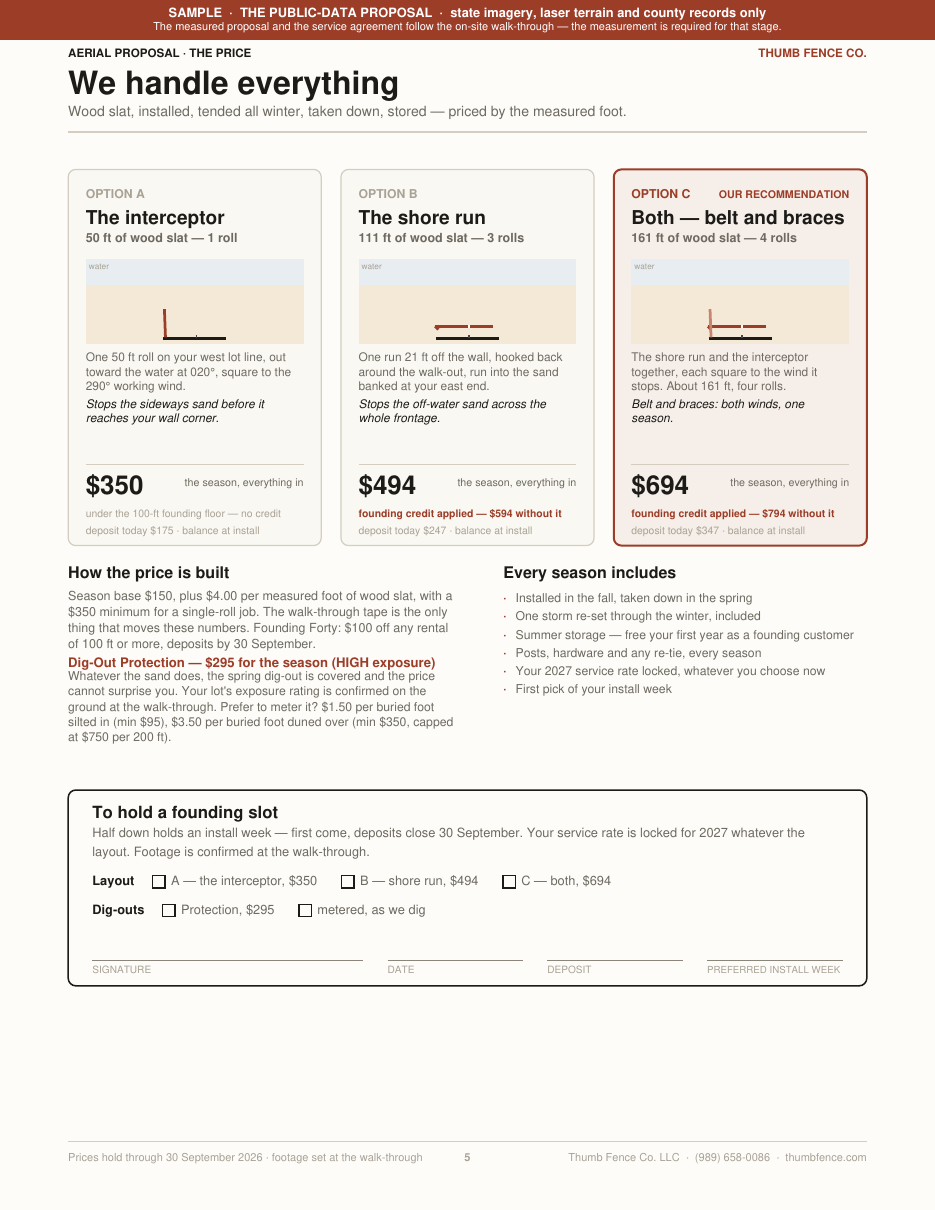
Send us a shoreline address and, before anyone drives out, you get this: a five-page proposal built entirely from public data — the State of Michigan's foot-resolution imagery, its laser terrain survey, and the county's address records — with the fence lines drawn on your lot and three options priced by the foot.
Two stages, on purpose
The public-data proposal — this document
Your lot lines from county records, your beach from state imagery, your seawall or bank from the 2016 laser terrain (with today's lake level from the NOAA gauge at Harbor Beach), the two winds that move sand on your shore, fence lines placed by the same rules we use on every job, and three options priced per measured foot. It answers the question people actually have — what would this cost me, and where would it go — without a visit and without a sales call.
What it can't know: whether your frontage is exactly what the county's address points suggest (merged parcels happen), whether there's a low wall or timber at the foot of your bank, where your stairs really are, and how your sand behaved last winter. So the prices are firm per foot and the footage is an estimate.
The measured proposal and the service agreement
We come out with a motion-capture survey tool and walk your wall, your beach and the water's edge — typically a hundred or more height points, closing the survey loop back on its starting flag. From that comes the measured proposal: your real geometry to the inch, the fence lines set on your actual sand, the exact footage — and with it the seasonal service agreement, sent for e-signature. The on-site measurement is required for this stage; nothing is signed, and no deposit is taken, before it.
The sample, page by page
Built for a real Huron County shoreline lot — a seawall, beach stairs and a dune at one end — with the address withheld. Every real proposal follows the same five pages. Two things anchor the plan: your seawall, placed and aligned from the laser terrain, and the beach front, read from the imagery and the terrain at today's lake level. Your lot lines are struck square to the road, the way these lots are platted, and carried across the beach to the wall.
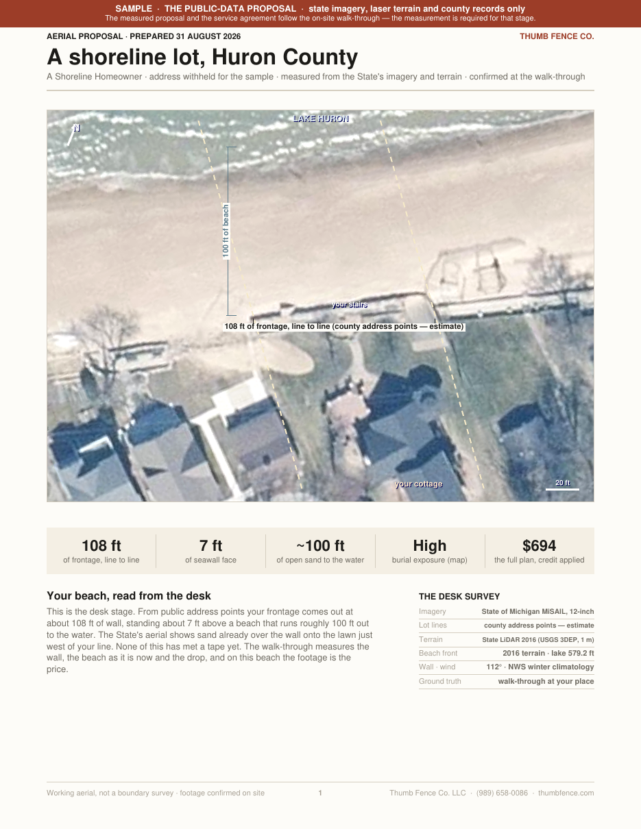
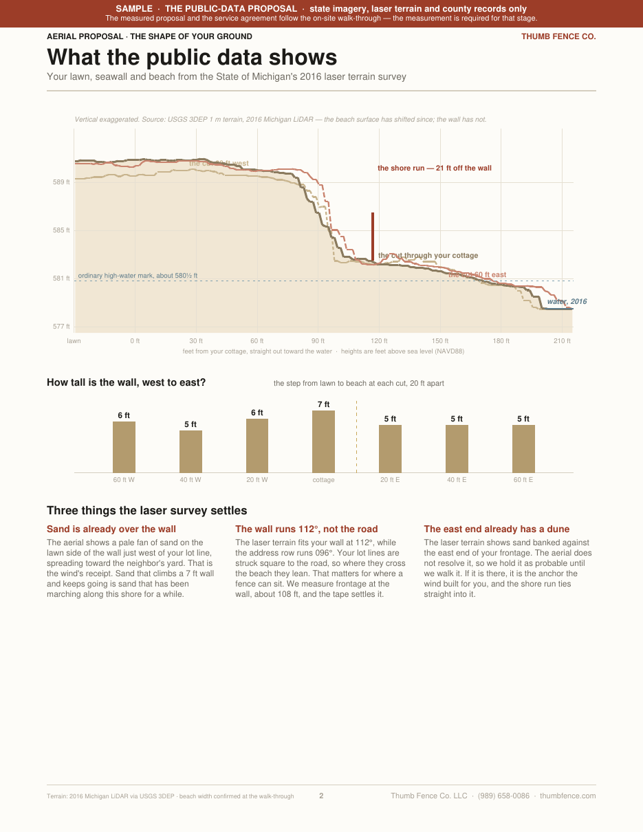
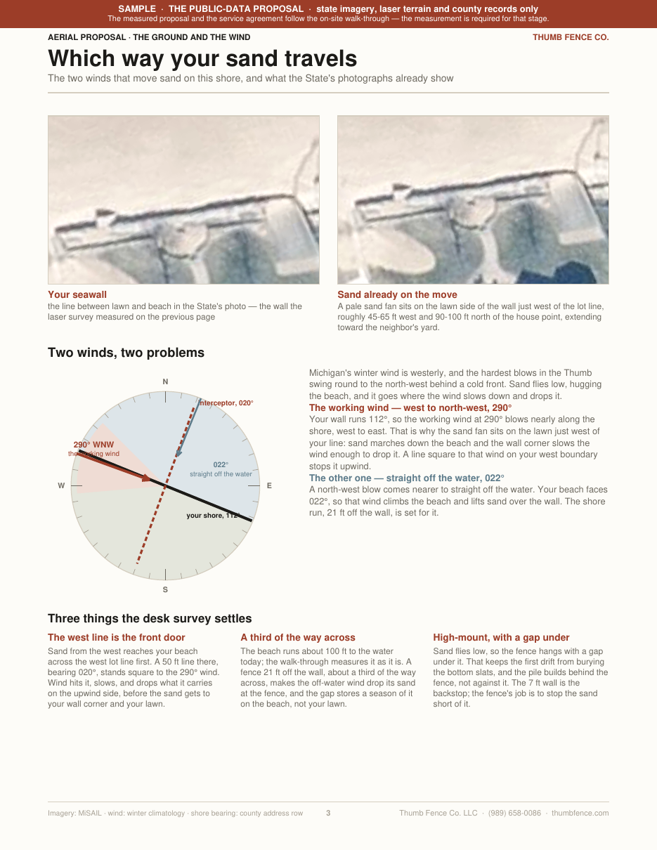
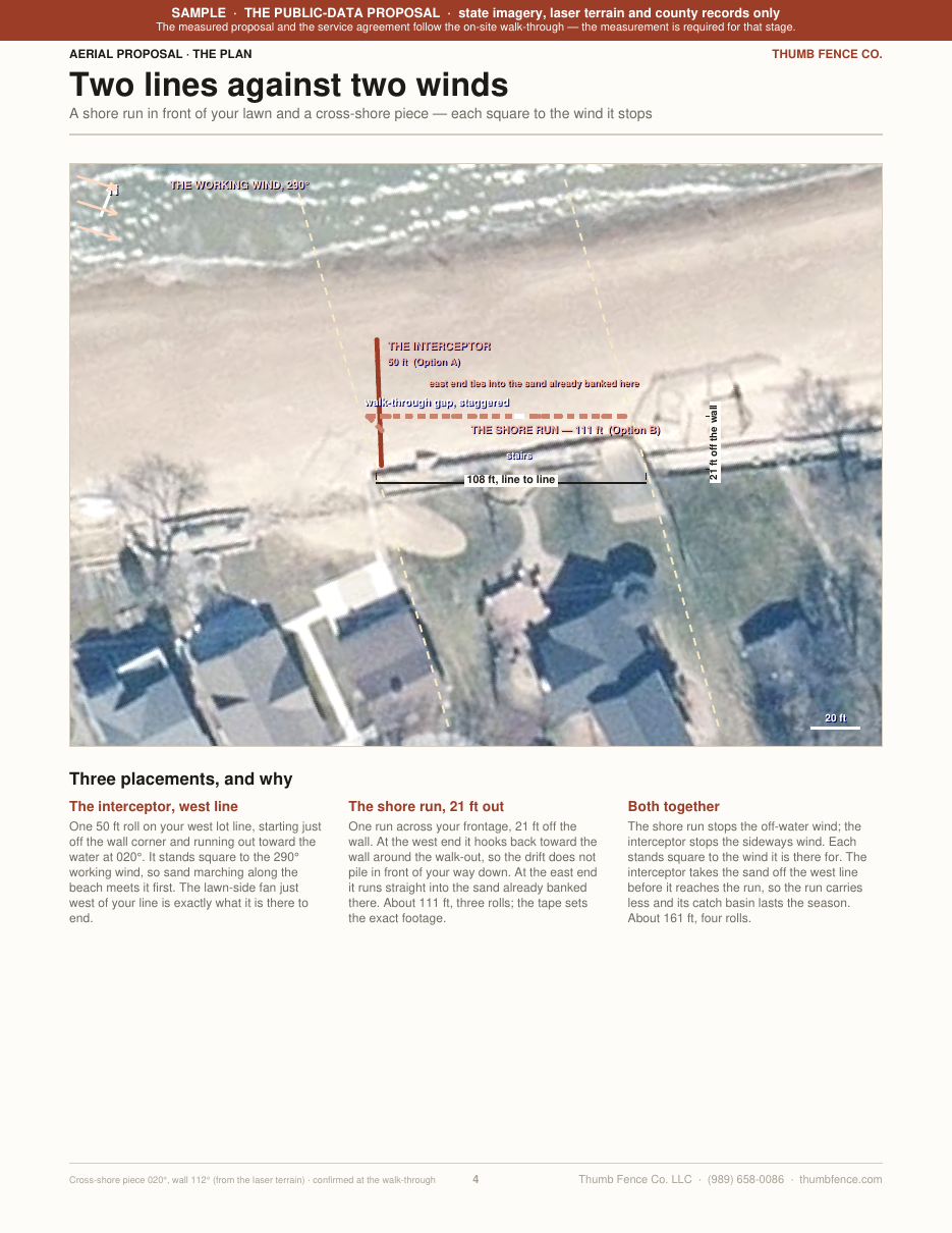
The same lot, after the walk-through
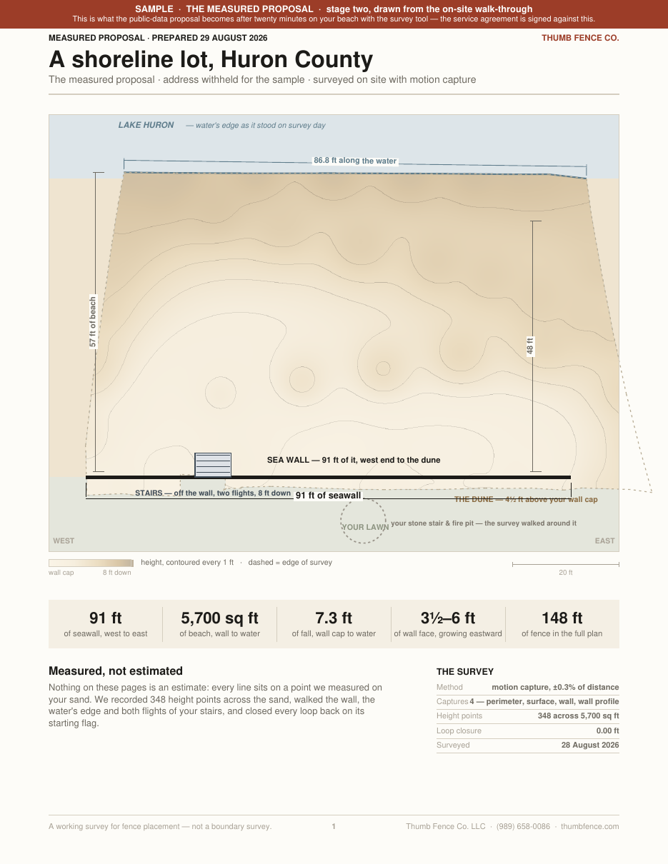
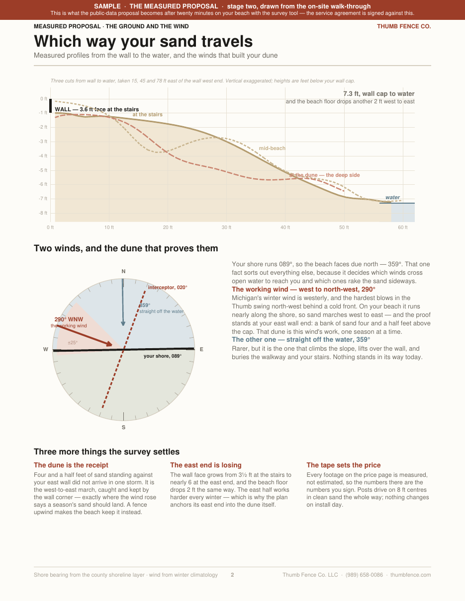
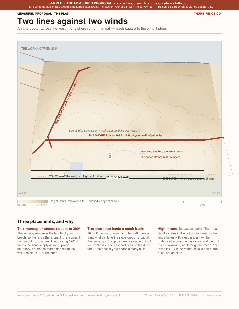
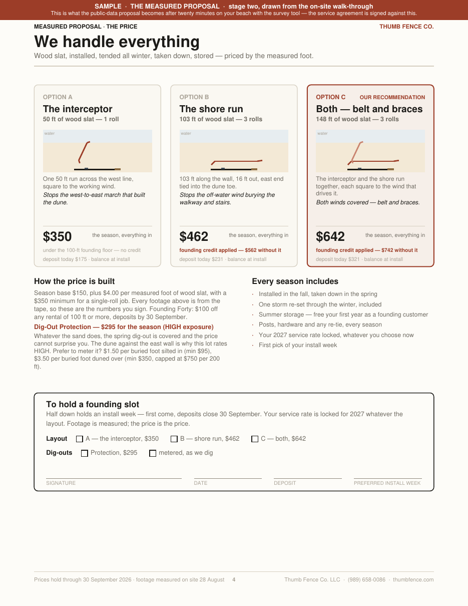
This is what Stage 2 looks like for the very same beach. Twenty minutes with the survey tool — 348 height points across the sand, the wall walked end to end, both flights of the stairs, the water's edge as it stood that day — and the desk plan becomes a measured one: the true 91 ft of wall, 57 ft of beach where the public record guessed a hundred, the stairs and the dune exactly where they are, and footages you sign against. Same fence lines, same rules; the numbers are simply real now.
Want yours?
Four fields on the quote form — name, email, address, phone. The public-data proposal lands in your inbox as a PDF; the walk-through is the next step, and it's the one that makes the numbers exact.